Página inicial
PLUS
Ferramentas de geração de IA
Novo
Gerador de imagens AI
Entregando criatividade à sua imaginação.
Novo
Upscaler de imagem AI
Amplie suas imagens em até 4x com um clique!
Novo
Preenchimento generativo de IA
Remova e substitua objetos em segundos!
Novo
Desfoque de Fundo com IA
Desfocar os fundos para destacar os objetos!
AI Background Remix
Fundos profissionais para seus produtos.
AI Image Extender
Amplie suas imagens para diferentes proporções.
Escrita de IA
O melhor companheiro de escrita para a era digital.
Remoção de fundo de IA
Remova facilmente fundos indesejados.
123RF PLUS
Obtenha soluções criativas com o auxílio de ferramentas de IA de ponta.
Ir para o PLUS
Temos duas novas ferramentas de IA!
Confira agora o Upscaler de imagem AI e o Preenchimento generativo de IA!
OK
Imagens Gratuitas
Stock
Fotos
Vetores
Vídeos
Áudios
Fontes
Corporate+
Preços
Ajuda
br
English
Deutsch
Español
Français
Magyar
Italiano
日本語
한국어
Nederland
Język polski
Português (PT)
Português (BR)
Русский язык
简体中文
繁體中文
Türkçe
Login
Vá ilimitado
Vídeos
Opções
PREMIUM
Todas as Imagens
Fotos
Vetores
Vídeos
Áudios
Fontes
FREE
PLUS
Filtrar
Pesquisa segura
Ordenar por
Relevância
Novo
Georank
Resolução
720p
1080
4K
Número de pessoas
Sem Pessoas
1
2
3
4+
FPS
23.98/24
25
29.7/30
60
> 60
Veja mais
Coleções
Tipo de conteúdo
Editorial
Imagem carregada
Em qualquer data
< 2 dias
Na última semana
No último mês
3 meses
Não incluir estas palavras
Filtrar
Vídeos
191 resultados
Página
de 2
Cropped image of man working with geodetic equipment
0:10
White man in orange vest prepare geodetic device for surveying
0:23
White man in orange vest prepare geodetic device for surveying
0:12
Surveyor makes plan of the land on the paper. Closeup shot.
0:29
Surveyor prepare geodetic device putting it in to the holder. Closeup shot.
0:06
Male hands working with geodetic equipment. Close-up shot
0:17
Handsome male engineer sitting on the ground at his outdoor workplace
0:09
Man in orange vest working with geodetic equipment. Close-up shot
0:19
Caucasian man in vest and helmet sitting on the ground at his outdoor workplace
0:10
Young surveyor working outdoor since early morning
0:11
Two surveyor in helmets performing geodesic measurements on top of the mountain
0:07
Two surveyor in helmets performing geodesic measurements on top of the mountain
0:18
Surveyor at work measuring the distance. One caucasian man in orange vest. Closeup shot.
0:10
Surveyors performing geodesic measurements and fixing them to paper
0:21
Caucasian worker in helmet and vest smiling talking by mobile phone
0:07
Surveyor engineer is measuring level on construction site. Geodesist ensure precise measurements before undertaking large construction projects. Concept of landscape design
0:07
A male surveyor in work clothes adjusts the equipment on the construction site. The concept of landscape design, geodesy
0:10
White man in orange vest prepare geodetic device for surveying
0:14
Geodesist sitting on the concrete plate and corecting data in geodetic device
0:10
Caucasian worker in vest and helmet sitting on the concrete plates
0:14
Male surveyor sitting on concrete at his outdoor workplace against of sun
0:10
Surveyor in helmet and orange vest sitting perfoming measurements outdoor
0:14
Surveyor at work measuring the distance. One caucasian man in orange vest. Overall plan.Warm season.
0:10
White man in orange vest prepare geodetic device for surveying
0:16
Two surveyor wearing orange vest enjoying their work
0:12
Two surveyors working on the ground since early morning
0:13
Surveyor perfoming geodetic measurement outdoor. Against the sun shot
0:08
Surveyor performing geodesic measurements on top of the mountain
0:07
Surveyor performing geodesic measurements on top of the mountain.
0:07
White man in orange vest prepare geodetic device for surveying
0:11
Surveyor at work measuring the distance. One caucasian man in orange vest. Portrait shot.
0:11
Surveyor engineer is measuring level on construction site. Geodesist ensure precise measurements before undertaking large construction projects. Concept of landscape design
0:36
Male and female surveyors in working uniform and helmets smiling Shake hands after the deal ends, that mean good work. The concept of landscape design, geodesy
0:11
White man in orange vest prepare geodetic device for surveying
0:11
Handsome male engineer in vest and helmet sitting at his outdoor workplace
0:08
Two surveyor in helmets performing geodesic measurements on top of the mountain
0:21
Caucasian man in helmet and vest looking up performing geodesic measurements
0:07
Workers performing level measurements outdoor
0:26
Two surveyor in helmets performing geodesic measurements on top of the mountain
0:07
A male surveyor in work clothes adjusts the equipment on the construction site. The concept of landscape design, geodesy
0:19
young woman surveyor in green work clothes and helmet adjusts the equipment, produces calculations and writes to the notebook on the construction site. The concept of landscape design, geodesy
0:22
Young worker perfoming geodetic measurement outdoor. Against the sun shot
0:10
Surveyor answering mobile phone drawing lines at workplace, outdoor
0:31
Builder in vest and helmet sitting outdoor and working with geodetic device
0:13
Surveyor at work measuring the distance. One caucasian man in orange vest. Middle plan. Warm season.
0:17
White man in orange vest prepare geodetic device for surveying. Field controller on smart pole for surveying. GPS surveying instrument Closeup shot.
0:18
White man in orange vest prepare geodetic device for surveying
0:18
Two surveyor on the top of the mountain with town and sea background
0:33
young smileing woman surveyor in green work clothes and helmet adjusts the equipment, produces calculations and writes to the notebook on the construction site. The concept of landscape design, geodesy
0:11
White man in orange vest prepare geodetic device for surveying. Field controller on smart pole for surveying. GPS surveying instrument. Closeup shot.
0:05
Surveyors performing geodesic measurements and fixing them to paper
0:11
Builder talking by smart phone at workplace outdoor witing sitting against sun
0:09
Constructor answering calling of mobile phone drawing lines at workplace
0:20
Two caucasian men removing equipment from the trunk
0:14
Two surveyors in helmets performing geodesic measurements on top of the mountain
0:10
Two surveyor in helmets performing geodesic measurements on top of the mountain
0:05
White man in orange vest fold geodetic device for surveying
0:07
Surveyor at work measuring the distance. One caucasian man in orange vest. Portrait shot. Warm season.
0:11
KAZAN, TATARSTAN / RUSSIA - AUGUST 23 2017: Backside view young people listen to interesting lecture and mineral samples in case on foreground on August 23 in Kazan
4K
0:11
KAZAN, TATARSTAN / RUSSIA - AUGUST 23 2017: Worker in green uniform and cap carrying large bobbin with wire along field and men taking tools out of car on August 23 in Kazan
4K
0:06
Hands in Gloves Gets out Ground Samples from Tube
4K
0:15
Courageous Employee Works on Geodetic Machine Top
4K
0:06
Total center device on tripod with laser for leveling other devices to level construction site. Photo - JPEG video codec
0:12
Total center device with laser for leveling other devices to level construction site. H.264 video codec
0:14
Total center device with laser for leveling other devices to level construction site. H.264 video codec
0:16
male construction worker working with theodolite, level tool
0:07
The edge of the land, a precipice, a very steep unapproachable cliff in the Crimea. The forest and thickets below. Drone aerial shot.
4K
0:15
Surveyor engineer is measuring level on construction site. Geodesist ensure precise measurements before undertaking large construction projects. Concept of landscape design. High quality 4k footage
4K
0:14
Surveyor engineer is measuring level on construction site. Geodesist ensure precise measurements before undertaking large construction projects. Concept of landscape design. High quality 4k footage
4K
0:14
Surveyor engineer is measuring level on construction site. Geodesist ensure precise measurements before undertaking large construction projects. Concept of landscape design. High quality 4k footage
4K
0:14
Surveyor engineer is measuring level on construction site. Geodesist ensure precise measurements before undertaking large construction projects. Concept of landscape design. High quality 4k footage
4K
0:14
Surveyor engineer is measuring level on construction site. Geodesist ensure precise measurements before undertaking large construction projects. Concept of landscape design. High quality 4k footage
4K
0:14
Surveyor engineer is measuring level on construction site. Geodesist ensure precise measurements before undertaking large construction projects. Concept of landscape design. High quality 4k footage
4K
0:14
Surveyor engineer is measuring level on construction site. Geodesist ensure precise measurements before undertaking large construction projects. Concept of landscape design. High quality 4k footage
4K
0:14
Surveyor engineer is measuring level on construction site. Geodesist ensure precise measurements before undertaking large construction projects. Concept of landscape design. High quality 4k footage
4K
0:14
Surveyor engineer is measuring level on construction site. Geodesist ensure precise measurements before undertaking large construction projects. Concept of landscape design. High quality 4k footage
4K
0:14
big industrial district on the outskirts of the city
4K
0:02
Worker in orange vest fold geodetic device for surveying
0:06
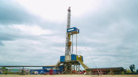
geodetic station with drill operates at oil field timelapse
4K
0:06
NAGARKOT, NEPAL - CIRCA April 2015: Nagarkot View Tower drone footage in Nepal
0:07
dirty water flows through concrete tube at site
0:08
geodetic survey station with equipment on oilfield aerial
4K
0:51
motion around geodetic survey station with drill aerial
4K
0:51
Surveyor engineer is measuring level on construction site. Geodesist ensure precise measurements before undertaking large construction projects. Concept of landscape design. High quality 4k footage
4K
0:14
Surveyor engineer is measuring level on construction site. Geodesist ensure precise measurements before undertaking large construction projects. Concept of landscape design. High quality 4k footage
4K
0:14
Surveyor engineer is measuring level on construction site. Geodesist ensure precise measurements before undertaking large construction projects. Concept of landscape design. High quality 4k footage
4K
0:14
Surveyor engineer is measuring level on construction site. Geodesist ensure precise measurements before undertaking large construction projects. Concept of landscape design. High quality 4k footage
4K
0:14
Surveyor engineer is measuring level on construction site. Geodesist ensure precise measurements before undertaking large construction projects. Concept of landscape design. High quality 4k footage
4K
0:14
Surveyor engineer is measuring level on construction site. Geodesist ensure precise measurements before undertaking large construction projects. Concept of landscape design. High quality 4k footage
4K
0:14
Surveyor engineer is measuring level on construction site. Geodesist ensure precise measurements before undertaking large construction projects. Concept of landscape design. High quality 4k footage
4K
0:14
Dirty Road to Modern Geodetic Station Aerial View
4K
0:52
KAZAN, TATARSTAN / RUSSIA - AUGUST 23 2017: Closeup of a joyful cute girl students looking at a beautiful mineral samples on shelves at excursion on August 23 in Kazan
4K
0:15
KAZAN, TATARSTAN / RUSSIA - AUGUST 23 2017: Middle-aged man walks from behind book shelf with gas and oil
4K
0:12
workers walk to drill at geodetic survey site aerial view
4K
0:29
geodetic survey station operates on oilfield timelapse
4K
0:06
landscape of field and sky with pipe on foreground timelapse
4K
0:06
Total center device with laser for leveling other devices to level construction site. Photo - JPEG video codec
0:13
Wide mountain with a steep slope, panorama. A bird flies by, low clouds. Drone aerial shot.
4K
0:12
Surveyor engineer is measuring level on construction site. Geodesist ensure precise measurements before undertaking large construction projects. Concept of landscape design. High quality 4k footage
4K
0:14
Surveyor engineer is measuring level on construction site. Geodesist ensure precise measurements before undertaking large construction projects. Concept of landscape design. High quality 4k footage
4K
0:14
Próxima Página
Página
de 2

 Filtrar


 Novo
Novo
 Novo
Novo
 Novo
Novo