filter-iconFiltro
close-icon
Tipo de medio
Tipo de Licença
Orientação
Estilo
Excluir

World Political Map Vetores Stock e Ilustrações

Earth map with countries divided by color and description of political world map vector illustration
Earth map with countries divided by color and description of political world map vector illustration123RF Premium
VetoresSimilar Images
Earth map with countries divided by color and description of political world map vector illustration
VetoresSimilar Images
The political map of the world illustration
VetoresSimilar Images
World map layered and editable
VetoresSimilar Images
Dotted political world map with capitals Imagens
Dotted political world map with capitals
VetoresSimilar Images
World map atlas colored political map with blue seas and oceans vector illustration
World map atlas colored political map with blue seas and oceans vector illustration123RF Premium
VetoresSimilar Images
World map in french language Ilustrações vetoriais
World map in french language123RF Premium
VetoresSimilar Images
World map colorful countries atlas illustration eps10 vector file organized in layers for easy editing
VetoresSimilar Images
Colorful world political map with clearly labeled separated layers vector illustration
VetoresSimilar Images
Map of world football or soccer confederations conmebol concacaf caf uefa afc and ofc
Map of world football or soccer confederations conmebol concacaf caf uefa afc and ofc123RF Premium
VetoresSimilar Images
High detailed color world map sapital and big cities vector
VetoresSimilar Images
World map
World map
VetoresSimilar Images
Simple colorful world map vector eps 10 Imagens
Simple colorful world map vector eps 10
VetoresSimilar Images
Political world map vector illustration with different colors for each continent and isolated on white background with country names in japanese editable and clearly labeled layers Imagens
Political world map vector illustration with different colors for each continent and isolated on white background with country names in japanese editable and clearly labeled layers123RF Premium
VetoresSimilar Images
World map in russian
VetoresSimilar Images
Colorful vector world map complete with all countries and capital cities names vector illustration Imagens
Colorful vector world map complete with all countries and capital cities names vector illustration123RF Premium
VetoresSimilar Images
Polygonal map of the world foucaut s sinusoidal projection of the world purple green colored polygons contemporary vector illustration Imagens
Polygonal map of the world foucaut s sinusoidal projection of the world purple green colored polygons contemporary vector illustration123RF Premium
VetoresSimilar Images
Vector illustration of a detailed political world map with all country names colored by continent
VetoresSimilar Images
Map of the world with countries
VetoresSimilar Images
High detail vector political world map illustration
VetoresSimilar Images
World map vintage political vector illustration layers Imagens
World map vintage political vector illustration layers123RF Premium
VetoresSimilar Images
World map design vector illustration eps10 graphic
VetoresSimilar Images
High detailed world map vector illustration
VetoresSimilar Images
Colorful classic robinson projection vector map of the world cleverly layered and with names of all countries capitals and main cities main geographical features Imagens
Colorful classic robinson projection vector map of the world cleverly layered and with names of all countries capitals and main cities main geographical features
VetoresSimilar Images
Hand drawn realistic world map concept with doodle icons
VetoresSimilar Images
World map with globes vector
VetoresSimilar Images
Colorful political map world continents
Colorful political map world continents123RF Premium
VetoresSimilar Images
Colored world map and navigation icons illustration
VetoresSimilar Images
Colored map of world with countries borders vector iilustration Imagens
Colored map of world with countries borders vector iilustration
VetoresSimilar Images
Political world map in mercator projection
VetoresSimilar Images
Grand world map graphic element vector illustration
VetoresSimilar Images
World map atlas colored political map with blue seas and oceans vector illustration Ilustrações vetoriais
World map atlas colored political map with blue seas and oceans vector illustration123RF Premium
VetoresSimilar Images
Vector illustration map of the world
VetoresSimilar Images
World map with japan small information box and flag
World map with japan small information box and flag123RF Premium
VetoresSimilar Images
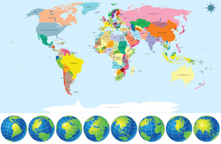
Political world map with earth globes
VetoresSimilar Images
Colorful geopolitical map of world bottom perspective view with background grid vector illustration
Colorful geopolitical map of world bottom perspective view with background grid vector illustration123RF Premium
VetoresSimilar Images
World map illustration infographics geometric concept design
World map illustration infographics geometric concept design123RF Premium
VetoresSimilar Images
High detailed political map of world
High detailed political map of world123RF Premium
VetoresSimilar Images
Colorful map of world doivided into regions simple flat vector illustration
Colorful map of world doivided into regions simple flat vector illustration123RF Premium
VetoresSimilar Images
High detailed political map of world
High detailed political map of world123RF Premium
VetoresSimilar Images
World timezone map vector illustration
VetoresSimilar Images
Political map of world with antarctica countries in four different colors without borders on dark grey background Ilustrações vetoriais
Political map of world with antarctica countries in four different colors without borders on dark grey background123RF Premium
VetoresSimilar Images
Colorful political map world continents
Colorful political map world continents123RF Premium
VetoresSimilar Images
Highly detailed political world map
VetoresSimilar Images
Map of world football or soccer confederations conmebol concacaf caf uefa afc and ofc Ilustrações vetoriais
Map of world football or soccer confederations conmebol concacaf caf uefa afc and ofc123RF Premium
VetoresSimilar Images
Gold world map
Gold world map
VetoresSimilar Images
Vector colorful political map of the world Imagens
Vector colorful political map of the world
VetoresSimilar Images
Southern asia map detailed vector illustration Imagens
Southern asia map detailed vector illustration
VetoresSimilar Images
World map
World map
VetoresSimilar Images
World map divided into six continents each continent in different color simple flat vector illustration
World map divided into six continents each continent in different color simple flat vector illustration123RF Premium
VetoresSimilar Images
Highly detailed political world map with capitals rivers separated layers vector illustration
VetoresSimilar Images
Political physical topographic colored world map info graphic vector illustration
VetoresSimilar Images
World map and ribbon a flat design for web and mobile app
VetoresSimilar Images
Continents and countries on the world map marked colored highly detailed world map
VetoresSimilar Images
Detailed world map with countries political map with individual drawn objects separated country and national borders asia africa america australia europe etc easy editable colors
VetoresSimilar Images
Network map
Network map
VetoresSimilar Images
World map infographic template all countries are selectable
VetoresSimilar Images
Grand world map graphic element vector illustration
VetoresSimilar Images
Vector world map using different colors Imagens
Vector world map using different colors
VetoresSimilar Images
Political world map vector illustration isolated on white background editable and clearly labeled layers
VetoresSimilar Images
World map
World map
VetoresSimilar Images
Detailed world map with names of continent and countries vector isolated by group Imagens
Detailed world map with names of continent and countries vector isolated by group
VetoresSimilar Images
Modern digital world map globalization concept vector illustration
VetoresSimilar Images
World map with globes detailed editable vector include all names of countries and capitals outline national border lines
VetoresSimilar Images
World map
World map
VetoresSimilar Images
Political world map on ocean blue background with every state labeled and selectable labeled in layers panel also versatile file turn on an off visibility and color of each country in one click
VetoresSimilar Images
Eurasia europa russia china india indonesia thailand africa map detailed vector illustration Imagens
Eurasia europa russia china india indonesia thailand africa map detailed vector illustration
VetoresSimilar Images
The minimalistic worldwide map
VetoresSimilar Images
New highly detailed political world map with capitals and rivers vector illustration separated layers Imagens
New highly detailed political world map with capitals and rivers vector illustration separated layers
VetoresSimilar Images
Modern globe drawing concept vector illustration
VetoresSimilar Images
World map vector illustration infographics with highlighted 6 largest countries by area
World map vector illustration infographics with highlighted 6 largest countries by area123RF Premium
VetoresSimilar Images
Niger and nauru flags for official meeting against background of world map Imagens
Niger and nauru flags for official meeting against background of world map123RF Premium
VetoresSimilar Images
Asia world map vector illustration
VetoresSimilar Images
World map
World map
VetoresSimilar Images
World map with blue continents on gray background vector illustration eps 10 Ilustrações vetoriais
World map with blue continents on gray background vector illustration eps 10123RF Premium
VetoresSimilar Images
Eurasia europa russia china india indonesia thailand africa map detailed vector illustration
VetoresSimilar Images
World map and flags borders countries and cities vector illustration
VetoresSimilar Images
Political world map isolated on white background vector illustration
VetoresSimilar Images
World map countries Ilustrações vetoriais
World map countries123RF Premium
VetoresSimilar Images
Political world map detailed continents countries borders and names atlas for global travel statistic or infographic design vector illustration Imagens
Political world map detailed continents countries borders and names atlas for global travel statistic or infographic design vector illustration123RF Premium
VetoresSimilar Images
World map america centered green hue colored on dark background high detailed political map of world with country capital ocean and sea names labeling
World map america centered green hue colored on dark background high detailed political map of world with country capital ocean and sea names labeling123RF Premium
VetoresSimilar Images
Political map of the world
VetoresSimilar Images
Colorful vector world map complete with all countries and capital cities names vector illustration
Colorful vector world map complete with all countries and capital cities names vector illustration123RF Premium
VetoresSimilar Images
National flags and world map
VetoresSimilar Images
World map full color high detail separated all countries vector illustration on white background
VetoresSimilar Images
World map vector illustration Imagens
World map vector illustration
VetoresSimilar Images
Globe with signals application
VetoresSimilar Images
Globe world map vector illustration
Globe world map vector illustration123RF Premium
VetoresSimilar Images
Vector map of the world steve waterman s butterfly projection of the world purple orange colored polygons creative vector illustration
Vector map of the world steve waterman s butterfly projection of the world purple orange colored polygons creative vector illustration123RF Premium
VetoresSimilar Images
Polical map of the world vector illustration
Polical map of the world vector illustration123RF Premium
VetoresSimilar Images
Blank white world map isolated on blue background world map vector template for website infographics design flat earth world map illustration Imagens
Blank white world map isolated on blue background world map vector template for website infographics design flat earth world map illustration
VetoresSimilar Images
World map
World map
VetoresSimilar Images
High detailed political map of world
High detailed political map of world123RF Premium
VetoresSimilar Images
Blue map of the world on white background
Blue map of the world on white background123RF Premium
VetoresSimilar Images
Niger and micronesia flags for official meeting against background of world map
Niger and micronesia flags for official meeting against background of world map123RF Premium
VetoresSimilar Images
Vector world map Imagens
Vector world map
VetoresSimilar Images
World map with country names and borders europe asia africa in japanese
state names such as north america and oceania and country names such as japan australia a
World map with country names and borders europe asia africa in japanese state names such as north america and oceania and country names such as japan australia a123RF Premium
VetoresSimilar Images
Set elements of infographics world map and information graphics illustration world map vector illustration
VetoresSimilar Images
Vector paper world map illustration on blue retro background Imagens
Vector paper world map illustration on blue retro background
VetoresSimilar Images
Political blank world map vector illustration with different colors for each continent and isolated on white background editable and clearly labeled layers Imagens
Political blank world map vector illustration with different colors for each continent and isolated on white background editable and clearly labeled layers
VetoresSimilar Images