filter-iconFiltro
close-icon
Tipo de medio
Tipo de Licença
Orientação
Estilo
Excluir

North South East West Vetores Stock e Ilustrações

Map of devon in south west england united kingdom with regions and flags Ilustrações vetoriais
Map of devon in south west england united kingdom with regions and flags123RF Premium
VetoresSimilar Images
European country united kingdom and regions of england
VetoresSimilar Images
Vector map of merseyside in north west england united kingdom with regions and flags Ilustrações vetoriais
Vector map of merseyside in north west england united kingdom with regions and flags123RF Premium
VetoresSimilar Images
United kingdom regions map with administrative divisions and titles each of them flags of the united kingdom wales scotland and northern ireland location icons and national theme symbols pictographs Imagens
United kingdom regions map with administrative divisions and titles each of them flags of the united kingdom wales scotland and northern ireland location icons and national theme symbols pictographs
VetoresSimilar Images
Map of dorset in south west england united kingdom with regions and flags Ilustrações vetoriais
Map of dorset in south west england united kingdom with regions and flags123RF Premium
VetoresSimilar Images
World map outline vector of provinces or states
World map outline vector of provinces or states123RF Premium
VetoresSimilar Images
South africa map and flag highly detailed vector illustration
VetoresSimilar Images
Vector map of lincolnshire in east midlands united kingdom with regions england vector map
VetoresSimilar Images
Map of somerset in south west england united kingdom with regions and flags
Map of somerset in south west england united kingdom with regions and flags123RF Premium
VetoresSimilar Images
Vector map of greater manchester in north west england united kingdom with regions and flags Ilustrações vetoriais
Vector map of greater manchester in north west england united kingdom with regions and flags123RF Premium
VetoresSimilar Images
European country united kingdom and regions of england Imagens
European country united kingdom and regions of england
VetoresSimilar Images
World map outline vector of provinces or states
World map outline vector of provinces or states123RF Premium
VetoresSimilar Images
Vector map of cheshire in north west england united kingdom with regions and flags
Vector map of cheshire in north west england united kingdom with regions and flags123RF Premium
VetoresSimilar Images
World map outline vector of provinces or states Imagens
World map outline vector of provinces or states123RF Premium
VetoresSimilar Images
World map outline vector of provinces or states
World map outline vector of provinces or states123RF Premium
VetoresSimilar Images
World map outline vector of provinces or states
World map outline vector of provinces or states123RF Premium
VetoresSimilar Images
European country united kingdom and regions of england
VetoresSimilar Images
Vector map of lancashire in north west england united kingdom with regions and flags
Vector map of lancashire in north west england united kingdom with regions and flags123RF Premium
VetoresSimilar Images
World map outline vector of provinces or states Imagens
World map outline vector of provinces or states123RF Premium
VetoresSimilar Images
World map outline vector of provinces or states Imagens
World map outline vector of provinces or states123RF Premium
VetoresSimilar Images
World map outline vector of provinces or states Imagens
World map outline vector of provinces or states123RF Premium
VetoresSimilar Images
World map outline vector of provinces or states
World map outline vector of provinces or states123RF Premium
VetoresSimilar Images
World map outline vector of provinces or states
World map outline vector of provinces or states123RF Premium
VetoresSimilar Images
Color detailed map of the regions and countries of the british isles for your design Imagens
Color detailed map of the regions and countries of the british isles for your design
VetoresSimilar Images
World map outline vector of provinces or states
World map outline vector of provinces or states123RF Premium
VetoresSimilar Images
World map outline vector of provinces or states Imagens
World map outline vector of provinces or states123RF Premium
VetoresSimilar Images
Gray map of countries of africa
Gray map of countries of africa123RF Premium
VetoresSimilar Images
World map outline vector of provinces or states
World map outline vector of provinces or states123RF Premium
VetoresSimilar Images
Vector map of warwickshire in west midlands united kingdom with regions england vector map Imagens
Vector map of warwickshire in west midlands united kingdom with regions england vector map
VetoresSimilar Images
World map outline vector of provinces or states Imagens
World map outline vector of provinces or states123RF Premium
VetoresSimilar Images
Compass arrow vector icon n logotype north west east south star vector illustration white background eps10
VetoresSimilar Images
Vector map of west yorkshire in yorkshire and the humber united kingdom with regions england vector map Imagens
Vector map of west yorkshire in yorkshire and the humber united kingdom with regions england vector map
VetoresSimilar Images
World map outline vector of provinces or states
World map outline vector of provinces or states123RF Premium
VetoresSimilar Images
Vector map of merseyside in north west england united kingdom
VetoresSimilar Images
South africa map and flag highly detailed vector illustration
VetoresSimilar Images
Vector map of dorset in south west england united kingdom with regions and cities
Vector map of dorset in south west england united kingdom with regions and cities123RF Premium
VetoresSimilar Images
Vector map of norfolk in east of england united kingdom with regions and flags
Vector map of norfolk in east of england united kingdom with regions and flags123RF Premium
VetoresSimilar Images
World map outline vector of provinces or states
World map outline vector of provinces or states123RF Premium
VetoresSimilar Images
European country united kingdom and regions of england
VetoresSimilar Images
Regions of africa political map united nations geo scheme with single countries north west central east and southern africa in different colors english labeling illustration over white vector Imagens
Regions of africa political map united nations geo scheme with single countries north west central east and southern africa in different colors english labeling illustration over white vector
VetoresSimilar Images
Plexus world map vector flat design asia in center Imagens
Plexus world map vector flat design asia in center
VetoresSimilar Images
Vector map of cheshire in north west england united kingdom with regions england vector map
VetoresSimilar Images
World map outline vector of provinces or states Imagens
World map outline vector of provinces or states123RF Premium
VetoresSimilar Images
World map outline vector of provinces or states
World map outline vector of provinces or states123RF Premium
VetoresSimilar Images
World map outline vector of provinces or states
World map outline vector of provinces or states123RF Premium
VetoresSimilar Images
World map outline vector of provinces or states
World map outline vector of provinces or states123RF Premium
VetoresSimilar Images
World map outline vector of provinces or states
World map outline vector of provinces or states123RF Premium
VetoresSimilar Images
World map outline vector of provinces or states
World map outline vector of provinces or states123RF Premium
VetoresSimilar Images
World map outline vector of provinces or states Imagens
World map outline vector of provinces or states123RF Premium
VetoresSimilar Images
South africa map and flag highly detailed vector illustration
VetoresSimilar Images
South africa map and flag highly detailed vector illustration
VetoresSimilar Images
World map outline vector of provinces or states Imagens
World map outline vector of provinces or states123RF Premium
VetoresSimilar Images
World map outline vector of provinces or states
World map outline vector of provinces or states123RF Premium
VetoresSimilar Images
World map outline vector of provinces or states
World map outline vector of provinces or states123RF Premium
VetoresSimilar Images
Vector map of somerset in south west england united kingdom with regions and cities Ilustrações vetoriais
Vector map of somerset in south west england united kingdom with regions and cities123RF Premium
VetoresSimilar Images
Map of the regions of africa map of africa
VetoresSimilar Images
Vector highly detailed political map of england with regions and their capitals all elements are separated in editable layers clearly labeled eps 10 Imagens
Vector highly detailed political map of england with regions and their capitals all elements are separated in editable layers clearly labeled eps 10
VetoresSimilar Images
World map outline vector of provinces or states
World map outline vector of provinces or states123RF Premium
VetoresSimilar Images
World map outline vector of provinces or states
World map outline vector of provinces or states123RF Premium
VetoresSimilar Images
World map outline vector of provinces or states
World map outline vector of provinces or states123RF Premium
VetoresSimilar Images
World map outline vector of provinces or states Imagens
World map outline vector of provinces or states123RF Premium
VetoresSimilar Images
European country united kingdom and regions of england
VetoresSimilar Images
World map outline vector of provinces or states
World map outline vector of provinces or states123RF Premium
VetoresSimilar Images
World map outline vector of provinces or states
World map outline vector of provinces or states123RF Premium
VetoresSimilar Images
Map of the subdivisions of england with the highest tier of local government north east
VetoresSimilar Images
World map outline vector of provinces or states
World map outline vector of provinces or states123RF Premium
VetoresSimilar Images
World map outline vector of provinces or states
World map outline vector of provinces or states123RF Premium
VetoresSimilar Images
World map outline vector of provinces or states
World map outline vector of provinces or states123RF Premium
VetoresSimilar Images
Vector map of lincolnshire in east midlands united kingdom with regions and flags
Vector map of lincolnshire in east midlands united kingdom with regions and flags123RF Premium
VetoresSimilar Images
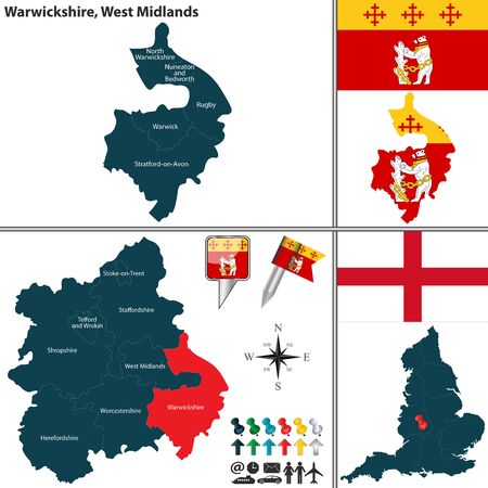
Vector map of warwickshire in west midlands united kingdom with regions and flags
Vector map of warwickshire in west midlands united kingdom with regions and flags123RF Premium
VetoresSimilar Images
World map outline vector of provinces or states
World map outline vector of provinces or states123RF Premium
VetoresSimilar Images
South africa map and flag highly detailed vector illustration
VetoresSimilar Images
Gray map of regions of africa
Gray map of regions of africa123RF Premium
VetoresSimilar Images
World map outline vector of provinces or states
World map outline vector of provinces or states123RF Premium
VetoresSimilar Images
World map outline vector of provinces or states
World map outline vector of provinces or states123RF Premium
VetoresSimilar Images
World map outline vector of provinces or states
World map outline vector of provinces or states123RF Premium
VetoresSimilar Images
South africa map and flag highly detailed vector illustration
VetoresSimilar Images
World map outline vector of provinces or states
World map outline vector of provinces or states123RF Premium
VetoresSimilar Images
World map outline vector of provinces or states Imagens
World map outline vector of provinces or states123RF Premium
VetoresSimilar Images
World map outline vector of provinces or states
World map outline vector of provinces or states123RF Premium
VetoresSimilar Images
Vector map of devon in south west england united kingdom with regions and cities
Vector map of devon in south west england united kingdom with regions and cities123RF Premium
VetoresSimilar Images
World map outline vector of provinces or states
World map outline vector of provinces or states123RF Premium
VetoresSimilar Images
Vector highly detailed political map of england with regions and their capitals all elements are separated in editable layers clearly labeled eps 10
VetoresSimilar Images
World map outline vector of provinces or states Imagens
World map outline vector of provinces or states123RF Premium
VetoresSimilar Images
World map outline vector of provinces or states
World map outline vector of provinces or states123RF Premium
VetoresSimilar Images
World map outline vector of provinces or states
World map outline vector of provinces or states123RF Premium
VetoresSimilar Images
South africa map and flag highly detailed vector illustration Imagens
South africa map and flag highly detailed vector illustration
VetoresSimilar Images
World map outline vector of provinces or states Imagens
World map outline vector of provinces or states123RF Premium
VetoresSimilar Images
World map outline vector of provinces or states
World map outline vector of provinces or states123RF Premium
VetoresSimilar Images
World map outline vector of provinces or states
World map outline vector of provinces or states123RF Premium
VetoresSimilar Images
World map outline vector of provinces or states
World map outline vector of provinces or states123RF Premium
VetoresSimilar Images
World map outline vector of provinces or states Imagens
World map outline vector of provinces or states123RF Premium
VetoresSimilar Images
World map outline vector of provinces or states
World map outline vector of provinces or states123RF Premium
VetoresSimilar Images
World map outline vector of provinces or states Imagens
World map outline vector of provinces or states123RF Premium
VetoresSimilar Images
Vector map of yorkshire and the humber united kingdom with regions and flags
Vector map of yorkshire and the humber united kingdom with regions and flags123RF Premium
VetoresSimilar Images
World map outline vector of provinces or states
World map outline vector of provinces or states123RF Premium
VetoresSimilar Images
World map outline vector of provinces or states
World map outline vector of provinces or states123RF Premium
VetoresSimilar Images
World map outline vector of provinces or states Imagens
World map outline vector of provinces or states123RF Premium
VetoresSimilar Images
World map outline vector of provinces or states
World map outline vector of provinces or states123RF Premium
VetoresSimilar Images
World map outline vector of provinces or states
World map outline vector of provinces or states123RF Premium
VetoresSimilar Images