filter-iconFiltro
close-icon
Tipo de medio
Tipo de Licença
Orientação
Estilo
Excluir

Latin American Map Vetores Stock e Ilustrações

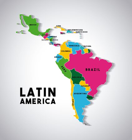
Latin america map with the names of the countries icon over white background vector illustration Imagens
Latin america map with the names of the countries icon over white background vector illustration
VetoresSimilar Images
Blank map of america Imagens
Blank map of america
VetoresSimilar Images
Map of latin america with the flags of countries colorful design vector illustration
VetoresSimilar Images
Latin america map icon over white background vector illustration
VetoresSimilar Images
South america political map with single states capitals most important cities national borders lakes and rivers vector illustration with english labeling and scaling
VetoresSimilar Images
World map design vector illustration eps10 graphic
VetoresSimilar Images
South america tourist map
South america tourist map123RF Premium
VetoresSimilar Images
Detailed map of south america vector
VetoresSimilar Images
Vector simple map of latin america country can be used for business designs presentation designs or any suitable designs
Vector simple map of latin america country can be used for business designs presentation designs or any suitable designs123RF Premium
VetoresSimilar Images
Highly detailed map of the continent of south america colored silhouette with borders and country names brazil and argentina and bolivia and venezuela and guyana and colombia and paraguay and peru and suriname and uruguay and chile and ecuador vector graphics white background Imagens
Highly detailed map of the continent of south america colored silhouette with borders and country names brazil and argentina and bolivia and venezuela and guyana and colombia and paraguay and peru and suriname and uruguay and chile and ecuador vector graphics white background123RF Premium
VetoresSimilar Images
Latin america countries political map with national borders countries from the northern border of mexico to the southern tip of south america including the caribbean english labeling illustration Imagens
Latin america countries political map with national borders countries from the northern border of mexico to the southern tip of south america including the caribbean english labeling illustration
VetoresSimilar Images
North and south america map vintage detailed vector illustration Imagens
North and south america map vintage detailed vector illustration
VetoresSimilar Images
North and south america political map on white and map icons vector illustration
North and south america political map on white and map icons vector illustration123RF Premium
VetoresSimilar Images
America map in typography word cloud concept Imagens
America map in typography word cloud concept
VetoresSimilar Images
Infographics america map flat design colors with names of individual states and islands blue background with orange points vector
Infographics america map flat design colors with names of individual states and islands blue background with orange points vector123RF Premium
VetoresSimilar Images
Latin america map icon over white background colorful design vector illustration Imagens
Latin america map icon over white background colorful design vector illustration
VetoresSimilar Images
America map
America map
VetoresSimilar Images
Map of america with borders as scrible
VetoresSimilar Images
North america with country borders vector illustration
VetoresSimilar Images
Mosaic south and north america map isolated on a white background vector geographic abstraction in pink and violet colors
VetoresSimilar Images
Map of latin america with the flags of countries colorful design vector illustration
VetoresSimilar Images
Detailed vector map of south america region
VetoresSimilar Images
Map of south america Imagens
Map of south america
VetoresSimilar Images
3d map of colombia with borders of regions
3d map of colombia with borders of regions123RF Premium
VetoresSimilar Images
Latin america map icon over white background colorful design vector illustration Imagens
Latin america map icon over white background colorful design vector illustration
VetoresSimilar Images
Central america design vector illustration eps10 graphic Imagens
Central america design vector illustration eps10 graphic
VetoresSimilar Images
Central america map separate individual states with state names color map isolated on white background vector
Central america map separate individual states with state names color map isolated on white background vector123RF Premium
VetoresSimilar Images
Vector illustrated map of brazil with states and administrative divisions and neighboring countries and territories editable and clearly labeled layers
Vector illustrated map of brazil with states and administrative divisions and neighboring countries and territories editable and clearly labeled layers123RF Premium
VetoresSimilar Images
Map of latin america with the flags of countries on location pins colorful design vector illustration
VetoresSimilar Images
Abstract continents of north and south america from triangles origami style vector polygonal pattern for your design Imagens
Abstract continents of north and south america from triangles origami style vector polygonal pattern for your design
VetoresSimilar Images
South america colorful vector map political version usable for travel marketing real estate and education Imagens
South america colorful vector map political version usable for travel marketing real estate and education
VetoresSimilar Images
Hand drawn south america travel map with pins vector illustration
VetoresSimilar Images
America map in typography word cloud concept
VetoresSimilar Images
Map of america continent
VetoresSimilar Images
Simple outline map of the south american andes mountains Ilustrações vetoriais
Simple outline map of the south american andes mountains123RF Premium
VetoresSimilar Images
Mozambique political map of administrative divisions provinces and capital city of maputo blank colorful vector map
Mozambique political map of administrative divisions provinces and capital city of maputo blank colorful vector map123RF Premium
VetoresSimilar Images
America map in typography word cloud concept names of countries
VetoresSimilar Images
South america map detailed vector illustration Imagens
South america map detailed vector illustration
VetoresSimilar Images
Colorful americas map with countries and capital cities
VetoresSimilar Images
Latin america single states map all countries in different full intense colors and with national borders from northern border of mexico to the southern tip of south america including the caribbean
VetoresSimilar Images
North and south america map vintage detailed vector illustration Imagens
North and south america map vintage detailed vector illustration
VetoresSimilar Images
Simplified schematic map of south america vector political map in high contrast of black and white Ilustrações vetoriais
Simplified schematic map of south america vector political map in high contrast of black and white123RF Premium
VetoresSimilar Images
Venezuela round logo badge of country with map of venezuela in world context country sticker stamp with globe map and round text astonishing vector illustration
Venezuela round logo badge of country with map of venezuela in world context country sticker stamp with globe map and round text astonishing vector illustration123RF Premium
VetoresSimilar Images
Vector illustration map of south and north america isolated on white background colorful americas map icon
VetoresSimilar Images
Political map of colombia
VetoresSimilar Images
Map of south and north america in atlantic ocean
VetoresSimilar Images
Map of south america with flags and location on world map Ilustrações vetoriais
Map of south america with flags and location on world map123RF Premium
VetoresSimilar Images
Map of the american vector illustration design Imagens
Map of the american vector illustration design
VetoresSimilar Images
Political map south america on a white background
Political map south america on a white background123RF Premium
VetoresSimilar Images
North south and central america continent world map made of colorful speech bubbles concept illustration background vector
VetoresSimilar Images
Typography poster south america map south america travel guide
VetoresSimilar Images
Blank blue similar north and south america map isolated on white background vector template for website design cover infographics graph illustration
VetoresSimilar Images
Map of america
Map of america
VetoresSimilar Images
South america map 4 bright color scheme high detailed political map south american continent with country ocean and sea names labeling
South america map 4 bright color scheme high detailed political map south american continent with country ocean and sea names labeling123RF Premium
VetoresSimilar Images
Bright colored peru shape multicolor geometric style country logo modern trendy design stylish vector illustration
Bright colored peru shape multicolor geometric style country logo modern trendy design stylish vector illustration123RF Premium
VetoresSimilar Images
Modern map america complete map with countries colored
VetoresSimilar Images
Illustration of a gray south america map on white background
VetoresSimilar Images
America map frame icon Imagens
America map frame icon
VetoresSimilar Images
Abstract high detailed blue map of south america isolated on white background
Abstract high detailed blue map of south america isolated on white background123RF Premium
VetoresSimilar Images
Mozambique political map of administrative divisions provinces and capital city of maputo blank vector map in cmyk colors
Mozambique political map of administrative divisions provinces and capital city of maputo blank vector map in cmyk colors123RF Premium
VetoresSimilar Images
Map of south america
Map of south america123RF Premium
VetoresSimilar Images
South america map green hue colored on dark background high detailed political map south american continent with country capital ocean and sea names labeling
South america map green hue colored on dark background high detailed political map south american continent with country capital ocean and sea names labeling123RF Premium
VetoresSimilar Images
American map abstract Imagens
American map abstract123RF Premium
VetoresSimilar Images
Argentina political map of administrative divisions provinces and autonomous city of buenos aires colorful 3d vector map with dropped shadow and country name labels
Argentina political map of administrative divisions provinces and autonomous city of buenos aires colorful 3d vector map with dropped shadow and country name labels123RF Premium
VetoresSimilar Images
Very simplified infographical political map of south america in green colors simple geometric vector illustration Ilustrações vetoriais
Very simplified infographical political map of south america in green colors simple geometric vector illustration123RF Premium
VetoresSimilar Images
Graphic vector map of central south america
Graphic vector map of central south america123RF Premium
VetoresSimilar Images
Brazil blue map with neighboring countries and names vector illustration
Brazil blue map with neighboring countries and names vector illustration123RF Premium
VetoresSimilar Images
American continent silhouette geography icon vector illustration design
American continent silhouette geography icon vector illustration design123RF Premium
VetoresSimilar Images
America map green
America map green123RF Premium
VetoresSimilar Images
Countries of central america map with administrative divisions of belize guatemala honduras el salvador nicaragua costa rica and panama colorful map with labels Ilustrações vetoriais
Countries of central america map with administrative divisions of belize guatemala honduras el salvador nicaragua costa rica and panama colorful map with labels123RF Premium
VetoresSimilar Images
Map of south america low polygon
VetoresSimilar Images
South america map with contry borders
VetoresSimilar Images
Coron island network map abstract geometric map of the island internet connections and telecommunication design charming vector illustration
Coron island network map abstract geometric map of the island internet connections and telecommunication design charming vector illustration123RF Premium
VetoresSimilar Images
Map of south america
Map of south america123RF Premium
VetoresSimilar Images
Planet map earth world sketch striped icon isolated and flat illustration vector graphic
VetoresSimilar Images
South america map vector illustration
VetoresSimilar Images
Vector illustration of continent of south america map
Vector illustration of continent of south america map123RF Premium
VetoresSimilar Images
Map of america Imagens
Map of america
VetoresSimilar Images
Map of america
Map of america
VetoresSimilar Images
South america political map with borders capitals and the largest rivers a continent bordered by the pacific and the atlantic ocean by north america and the caribbean sea
South america political map with borders capitals and the largest rivers a continent bordered by the pacific and the atlantic ocean by north america and the caribbean sea123RF Premium
VetoresSimilar Images
Political map of center america vector illustration design Imagens
Political map of center america vector illustration design
VetoresSimilar Images
Brazil regions vector geography background
VetoresSimilar Images
South america tourist map
South america tourist map123RF Premium
VetoresSimilar Images
America continent map in gray
VetoresSimilar Images
Linear style hand drawn travel map of south america with pins vector illustration
VetoresSimilar Images
Map of latin america with the countries demarcated in different colors colorful design vector illustration Imagens
Map of latin america with the countries demarcated in different colors colorful design vector illustration
VetoresSimilar Images
Map of america
Map of america
VetoresSimilar Images
Map of the countries of south america geographic map of the contours of different colors
Map of the countries of south america geographic map of the contours of different colors123RF Premium
VetoresSimilar Images
New continent geography maps icon vector illustration design
New continent geography maps icon vector illustration design123RF Premium
VetoresSimilar Images
Detailed south america vector map
VetoresSimilar Images
Map of america
Map of america
VetoresSimilar Images
San vicente department republic of el salvador departments of el salvador map vector illustration scribble sketch san vicente map Imagens
San vicente department republic of el salvador departments of el salvador map vector illustration scribble sketch san vicente map
VetoresSimilar Images
America map geographical design Imagens
America map geographical design123RF Premium
VetoresSimilar Images
North and south america map in colors of blue no text vector illustration
North and south america map in colors of blue no text vector illustration123RF Premium
VetoresSimilar Images
America map classic color detailed map with states islands and sea with names vector
America map classic color detailed map with states islands and sea with names vector123RF Premium
VetoresSimilar Images
America continent map with states and modern round shapes
VetoresSimilar Images
Doodle freehand drawing of south america countries map
Doodle freehand drawing of south america countries map123RF Premium
VetoresSimilar Images
North and south america political map and flat map markers vector illustration
North and south america political map and flat map markers vector illustration123RF Premium
VetoresSimilar Images
Vector world map
Vector world map
VetoresSimilar Images
Coron island geometric polygonal mosaic style island maps collection bright abstract tessellation low poly style modern design coron island polygonal maps for your infographics or presentation Imagens
Coron island geometric polygonal mosaic style island maps collection bright abstract tessellation low poly style modern design coron island polygonal maps for your infographics or presentation
VetoresSimilar Images