filter-iconFiltro
close-icon
Tipo de medio
Tipo de Licença
Orientação
Estilo
Excluir

Indian Ocean Vetores Stock e Ilustrações

Globe sketch with indian ocean in center earth map Imagens
Globe sketch with indian ocean in center earth map123RF Premium
VetoresSimilar Images
Map indian ocean
Map indian ocean
VetoresSimilar Images
Indian ocean region detailed editable map Imagens
Indian ocean region detailed editable map123RF Premium
VetoresSimilar Images
Map of the french southern and antarctic territories with flag
Map of the french southern and antarctic territories with flag123RF Premium
VetoresSimilar Images
Indian ocean text on a ribbon designed with white title and blue stripe vector banner with indian ocean tag on a transparent background Imagens
Indian ocean text on a ribbon designed with white title and blue stripe vector banner with indian ocean tag on a transparent background
VetoresSimilar Images
Indian ocean text textile seal stamp watermarks blue red fabric vectorized texture vector caption inside rounded rectangular banner rubber sign with fiber textile structure Imagens
Indian ocean text textile seal stamp watermarks blue red fabric vectorized texture vector caption inside rounded rectangular banner rubber sign with fiber textile structure
VetoresSimilar Images
Asia isometric map with natural attractions cartography nature concept geographical map with local relief asia largest most populous continent located in eastern and northern hemispheres vector
VetoresSimilar Images
South africa madagascar and the south pole
South africa madagascar and the south pole123RF Premium
VetoresSimilar Images
Fancy looking eastern hemisphere planet earth drawn in cartoon glossy 3d style with bright blue oceans and beautiful green continents
VetoresSimilar Images
Indian ocean watermark stamp text tag inside rounded rectangle with grunge design style vector variants are indigo blue red green ink colors rubber seal stamp with dust texture Imagens
Indian ocean watermark stamp text tag inside rounded rectangle with grunge design style vector variants are indigo blue red green ink colors rubber seal stamp with dust texture
VetoresSimilar Images
Asia with highlighted maldives map illustration
VetoresSimilar Images
Vector color map of indian ocean region Imagens
Vector color map of indian ocean region
VetoresSimilar Images
Flag of rounded square icon on white background vector illustration Ilustrações vetoriais
Flag of rounded square icon on white background vector illustration123RF Premium
VetoresSimilar Images
A red sailboat floats on the sea on a substitute ball to africa
A red sailboat floats on the sea on a substitute ball to africa123RF Premium
VetoresSimilar Images
World map
World map
VetoresSimilar Images
Asia with highlighted india map illustration
VetoresSimilar Images
Vector world globe map africa mediterranean sea arabian peninsula centered map blue planet sphere icon isolated on a dark background Imagens
Vector world globe map africa mediterranean sea arabian peninsula centered map blue planet sphere icon isolated on a dark background123RF Premium
VetoresSimilar Images
Indian coast guard day design background for greeting moment Imagens
Indian coast guard day design background for greeting moment123RF Premium
VetoresSimilar Images
Vector world globe map india middle east asia centered map blue planet sphere icon on a dark background
Vector world globe map india middle east asia centered map blue planet sphere icon on a dark background123RF Premium
VetoresSimilar Images
Animals and where they live our planet earth
VetoresSimilar Images
Indian ocean political map countries and borders world s third largest ocean division bounded by africa asia antarctica and australia named after india illustration english labeling vector
VetoresSimilar Images
Africa with highlighted mauritius map vector illustration
VetoresSimilar Images
Simple survey map of sri lanca and south india
Simple survey map of sri lanca and south india123RF Premium
VetoresSimilar Images
Indian coast guard day design background for greeting moment
Indian coast guard day design background for greeting moment123RF Premium
VetoresSimilar Images
India africa china indian ocean global world Ilustrações vetoriais
India africa china indian ocean global world123RF Premium
VetoresSimilar Images
World map with country names and borders europe asia africa in japanese
state names such as north america and oceania and country names such as japan australia a
World map with country names and borders europe asia africa in japanese state names such as north america and oceania and country names such as japan australia a123RF Premium
VetoresSimilar Images
Vector part of world map with west asian east european arabic and north african countries mixed with their national flags
VetoresSimilar Images
Hand drawn doodle map of india
Hand drawn doodle map of india123RF Premium
VetoresSimilar Images
Indian coast guard day design background for greeting moment
Indian coast guard day design background for greeting moment123RF Premium
VetoresSimilar Images
India political map with capital new delhi national borders important cities rivers and lakes english labeling and scaling illustration
VetoresSimilar Images
India africa china indian ocean global world
India africa china indian ocean global world123RF Premium
VetoresSimilar Images
Mayotte is an overseas department and region of france officially named department of mayotte
VetoresSimilar Images
Tasmania island state of australia political map located south of the australian mainland separated from it by bass strait surrounded by 1000 islands
Tasmania island state of australia political map located south of the australian mainland separated from it by bass strait surrounded by 1000 islands123RF Premium
VetoresSimilar Images
Earth s perspective design cross section exposed core mantle
VetoresSimilar Images
Detailed map of australia for your design Imagens
Detailed map of australia for your design
VetoresSimilar Images
High detail map of far east asia with a 3d globe centered on these countries
VetoresSimilar Images
Indonesia country vector color map
VetoresSimilar Images
Sri lanka and part of southern india political map democratic socialist republic of sri lanka formerly known as ceylon island country in south asia and indian ocean with de fa
Sri lanka and part of southern india political map democratic socialist republic of sri lanka formerly known as ceylon island country in south asia and indian ocean with de fa123RF Premium
VetoresSimilar Images
Highly detailed political map of continent located on the african continental plate with all countries and their capitals vector illustration Imagens
Highly detailed political map of continent located on the african continental plate with all countries and their capitals vector illustration
VetoresSimilar Images
Vector map of yemeni island of socotra Ilustrações vetoriais
Vector map of yemeni island of socotra123RF Premium
VetoresSimilar Images
Indian ocean region detailed editable map with regions cities and towns geographic sites vector eps 10 file
Indian ocean region detailed editable map with regions cities and towns geographic sites vector eps 10 file123RF Premium
VetoresSimilar Images
South africa madagascar south america and antarctica south pole
South africa madagascar south america and antarctica south pole123RF Premium
VetoresSimilar Images
Polygonal 3d icon of eurasia and indian ocean on planet earth as geometric concept of globe in origami style
VetoresSimilar Images
Tropical background with sea and palm trees summer sea background blue ocean sandy beach vector flat illustration with copy space
Tropical background with sea and palm trees summer sea background blue ocean sandy beach vector flat illustration with copy space123RF Premium
VetoresSimilar Images
Flag of india rectangular shape icon on white background vector illustration
Flag of india rectangular shape icon on white background vector illustration123RF Premium
VetoresSimilar Images
Button with flag of india illustration
VetoresSimilar Images
Road vector map of indonesian island of nias indonesia Ilustrações vetoriais
Road vector map of indonesian island of nias indonesia123RF Premium
VetoresSimilar Images
Road vector map of the indonesian island of bali Ilustrações vetoriais
Road vector map of the indonesian island of bali123RF Premium
VetoresSimilar Images
Republic of india isolated maps and official flag icon vector indian political map icons with general information south asia country geographic banner template travel and business concept map Imagens
Republic of india isolated maps and official flag icon vector indian political map icons with general information south asia country geographic banner template travel and business concept map
VetoresSimilar Images
Grunge rubber stamp or label with the name of maldives Imagens
Grunge rubber stamp or label with the name of maldives
VetoresSimilar Images
Indonesia map
Indonesia map123RF Premium
VetoresSimilar Images
Highly detailed political map of continent located on the african continental plate with all countries and their capitals vector illustration
VetoresSimilar Images
La reunion road and national park vector map with flag
La reunion road and national park vector map with flag123RF Premium
VetoresSimilar Images
Great detail illustration of the world map in vintage style on old parchment background Imagens
Great detail illustration of the world map in vintage style on old parchment background
VetoresSimilar Images
Political detailed map of india with all states and country boundary
VetoresSimilar Images
Asia with highlighted sri lanka map illustration
VetoresSimilar Images
Highly detailed political map of continent located on the african continental plate with all countries vector illustration
VetoresSimilar Images
Vector road map of the indonesian iceland of nias Ilustrações vetoriais
Vector road map of the indonesian iceland of nias123RF Premium
VetoresSimilar Images
Europe asia and africa map on wood background
Europe asia and africa map on wood background123RF Premium
VetoresSimilar Images
Vector world map
Vector world map
VetoresSimilar Images
Vector world globe map china eastern asia australia centered map blue planet sphere icon on a dark background Imagens
Vector world globe map china eastern asia australia centered map blue planet sphere icon on a dark background123RF Premium
VetoresSimilar Images
World map Imagens
World map
VetoresSimilar Images
Mozambique political map with capital maputo with national borders most important cities rivers and lakes illustration with english labeling and scaling
VetoresSimilar Images
Zanzibar island unguja tanzania gray political map largest most populated island of the zanzibar archipelago in the indian ocean separated from the african mainland
Zanzibar island unguja tanzania gray political map largest most populated island of the zanzibar archipelago in the indian ocean separated from the african mainland123RF Premium
VetoresSimilar Images
Vector world map and globe with compass icon
VetoresSimilar Images
Tropical background with sea and palm trees summer sea background blue ocean sandy beach vector flat illustration with copy space
Tropical background with sea and palm trees summer sea background blue ocean sandy beach vector flat illustration with copy space123RF Premium
VetoresSimilar Images
Flag of india illustration Imagens
Flag of india illustration
VetoresSimilar Images
Flag of tanzania vector illustration on a white background brush strokes are drawn by hand independence day
VetoresSimilar Images
World map states continents color coding
World map states continents color coding123RF Premium
VetoresSimilar Images
Vector map of the mascarene islands mauritius reunion rodrigues Ilustrações vetoriais
Vector map of the mascarene islands mauritius reunion rodrigues123RF Premium
VetoresSimilar Images
Tropical background with sea and palm trees summer sea background blue ocean sandy beach vector flat illustration with copy space
Tropical background with sea and palm trees summer sea background blue ocean sandy beach vector flat illustration with copy space123RF Premium
VetoresSimilar Images
Flag of india rounded square icon on white background vector illustration
Flag of india rounded square icon on white background vector illustration123RF Premium
VetoresSimilar Images
Highly detailed earth globe symbol australia indian and pacific oceans black on white background
Highly detailed earth globe symbol australia indian and pacific oceans black on white background123RF Premium
VetoresSimilar Images
Tropical background with sea and palm trees summer sea background blue ocean sandy beach vector flat illustration with copy space Imagens
Tropical background with sea and palm trees summer sea background blue ocean sandy beach vector flat illustration with copy space123RF Premium
VetoresSimilar Images
Republic of india vector map Ilustrações vetoriais
Republic of india vector map123RF Premium
VetoresSimilar Images
Political detailed map of india with all states and country boundary
VetoresSimilar Images
Set of buttons with flag of india illustration Imagens
Set of buttons with flag of india illustration
VetoresSimilar Images
The earth is under an umbrella isolated over white background
VetoresSimilar Images
World political map
World political map
VetoresSimilar Images
Vasco da portuguese explorer his first voyage from lisbon around africa to india discovery of the sea route through the atlantic and indian ocean vector map illustration
Vasco da portuguese explorer his first voyage from lisbon around africa to india discovery of the sea route through the atlantic and indian ocean vector map illustration123RF Premium
VetoresSimilar Images
A vintage colors high detail vector map illustration of the whole world map Imagens
A vintage colors high detail vector map illustration of the whole world map
VetoresSimilar Images
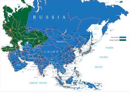
Asia road map
Asia road map123RF Premium
VetoresSimilar Images
Map of the french overseas territory of europe iceland between mozambique and madagascar
Map of the french overseas territory of europe iceland between mozambique and madagascar123RF Premium
VetoresSimilar Images
Coco keeling vector map
Coco keeling vector map123RF Premium
VetoresSimilar Images
Sandy ocean shore vector illustration of coast with yellow sand turquoise water and tropical seaside concept of exotic vacation
Sandy ocean shore vector illustration of coast with yellow sand turquoise water and tropical seaside concept of exotic vacation123RF Premium
VetoresSimilar Images
World map 7 continents green silhouettes
World map 7 continents green silhouettes123RF Premium
VetoresSimilar Images
Vector map of the states of southeast asia
Vector map of the states of southeast asia123RF Premium
VetoresSimilar Images
Sandy ocean shore vector illustration of coast with yellow sand turquoise water and tropical seaside concept of exotic vacation Imagens
Sandy ocean shore vector illustration of coast with yellow sand turquoise water and tropical seaside concept of exotic vacation123RF Premium
VetoresSimilar Images
Zanzibar island unguja tanzania political map largest most populated island of the zanzibar archipelago in the indian ocean
Zanzibar island unguja tanzania political map largest most populated island of the zanzibar archipelago in the indian ocean123RF Premium
VetoresSimilar Images
Vector map of yemen islands of socotra archipelago Ilustrações vetoriais
Vector map of yemen islands of socotra archipelago123RF Premium
VetoresSimilar Images
Political map of comoros with capital moroni important cities and the islands grande comore moheli and anjouan with the archipelago mayotte an oversea department of france
VetoresSimilar Images
Road map of the indonesian island sumatra
Road map of the indonesian island sumatra123RF Premium
VetoresSimilar Images
Global concept design drawing earth earth and arrow combination
VetoresSimilar Images
Administrative vector map of the east african country of somalia Ilustrações vetoriais
Administrative vector map of the east african country of somalia123RF Premium
VetoresSimilar Images
Vector world globe map africa mediterranean sea arabian peninsula centered map blue planet sphere icon isolated on a white background Imagens
Vector world globe map africa mediterranean sea arabian peninsula centered map blue planet sphere icon isolated on a white background123RF Premium
VetoresSimilar Images
Illustrated tourist map of indonesia attractions and national features of the country
Illustrated tourist map of indonesia attractions and national features of the country123RF Premium
VetoresSimilar Images
Illustration with a beautiful map of all the continents and oceans
VetoresSimilar Images
Auroville flag indian community india vector illustration Imagens
Auroville flag indian community india vector illustration123RF Premium
VetoresSimilar Images
Sri lanka map
Sri lanka map123RF Premium
VetoresSimilar Images
Waving india flag on flagpole
Waving india flag on flagpole123RF Premium
VetoresSimilar Images